.webp&w=1920&q=70)
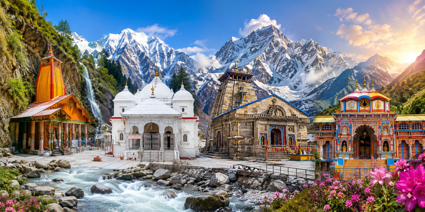
Detailed Char Dham Yatra route Map guide explaining travel sequence, road routes, distances and starting points.
Are you planning your Chardham Yatra but feeling confused about the route?
Chardham Yatra is not just a journey - it is a dream for many people in India. Every year, lakhs of devotees plan this sacred trip, and the first thing they search for is a clear char dham route map. When you understand the route before starting, the journey becomes much easier. The four holy places - Yamunotri, Gangotri, Kedarnath, and Badrinath yatra are located high in the mountains of Uttarakhand. Roads can be narrow, and weather can change quickly, so having a proper route map chardham yatra is very helpful.
When you follow a well-planned Char Dham Yatra Cost Guide with distance, you can travel without stress. It helps you decide where to stop, how long to rest, and how to move forward step by step. Families and elderly travellers feel more comfortable when they can check the full 4 dham map and understand the journey clearly.
The yatra usually starts from Haridwar or Rishikesh. From there, pilgrims travel to Yamunotri first. After that, they move to Gangotri, then Kedarnath, and finally Badrinath. This sequence is followed in most plans and is easy to track on any char dham route map.
Each dham has a different route. Some parts are covered by road, while others require short trekking. Many travellers also choose Chardham Yatra by Helicopter services for convenience, especially when they want a faster and easier way to reach Kedarnath, and a proper Helicopter guide helps them understand the full process clearly before booking and travelling. A proper chardham yatra distance chart helps you know the travel time and distance between each stop. For example, knowing the kedarnath to badrinath distance in advance helps in planning stays and travel breaks.
This guide by Musafirbaba is part of the complete Char Dham Yatra Travel Tips Guide. You will understand the full char dham yatra distance, important towns on the way, and useful travel tips. The goal is to make your journey smooth and worry-free.
With the right char dham route map, your yatra becomes more organized, peaceful, and enjoyable. Read this guide carefully, plan ahead, and experience a safe and blessed Chardham Yatra.Traditional Char Dham Yatra Route Sequence
Char Dham Route: Yamunotri - Gangotri - Kedarnath - Badrinath
The Chardham Yatra follows a fixed and traditional order, which is clearly shown in every char dham route map. The journey begins from Yamunotri, then moves to Gangotri, followed by Kedarnath, and finally ends at Badrinath. This sequence is explained in detail in the Char Dham Opening Dates Guide and holds deep spiritual meaning in the Uttarakhand pilgrimage route.
Pilgrims believe the yatra should start with Maa Yamuna at Yamunotri and then continue to Maa Ganga at Gangotri. After taking blessings from these sacred rivers, the journey moves ahead to Kedarnath, the abode of Lord Shiva. In the end, devotees reach Badrinath to seek blessings from Lord Vishnu. This spiritual flow is clearly explained in the route map char dham yatra, making it easier to understand the path of devotion.
Most travellers begin their journey from Haridwar or Rishikesh. From here, they follow the char dham route map by road, which is part of the broader Chardham travel guide Uttarakhand. The journey includes both smooth highways and challenging hill roads with sharp turns. Along the way, you will see green valleys, rivers, waterfalls, and peaceful mountain towns. The 4 dham map helps travellers stay on track without confusion.
The routes to Yamunotri and Gangotri are mostly covered by road. However, Kedarnath requires a trek from Gaurikund, which is an important part of the Kedarnath trekking route guide. Pilgrims can also choose horses, palkis, or helicopter services. Badrinath is again accessible by road, making the final part of the journey more comfortable. This route plan, shown in the char dham yatra route map with distance, helps manage travel energy, especially during longer stretches.
Simple Route Order as followed by most yatris
Haridwar/Rishikesh → Yamunotri
Yamunotri → Gangotri
Gangotri → Kedarnath
Kedarnath → Badrinath
There are many food stops, hotels, and dharamshalas available along the route. The chardham yatra distance chart gives a clear idea of distances between each dham and nearby towns. Signboards and local guidance also make the journey smoother. Knowing details like kedarnath to badrinath distance in advance helps with better planning.
Gangotri Dham Route Map
Gangotri is a place that brings instant peace to your mind, with fresh air and beautiful green hills all around. The journey here is not very difficult, which makes it a comfortable part of the yatra, especially when you follow a clear char dham route map. Many pilgrims prefer this route because it is mostly covered by road and feels easier before the tougher parts ahead.
The journey usually starts from towns like Uttarkashi or Harsil, which are key stops in the route map char dham yatra. From here, the road moves along the Bhagirathi River. For most of the journey, you will see the river flowing beside you. Tall mountains stand on both sides, and the road keeps turning again and again. Vehicles slow down at sharp bends, and sometimes the road becomes narrow. But the journey stays safe because drivers are experienced and locals are always ready to help, just as guided in the char dham route map by road.
On the way, you will find small shops, tea stalls, and fruit vendors. many yatris stop for a cup of chai or take a short break during their Char Dham Travel Experience Guide near the river. Some sit quietly and enjoy the cool breeze, while others stretch their legs. The natural sounds of flowing water and wind make the journey relaxing. These small moments are part of the experience shown in every char dham yatra route map with distance, where not just distance but the journey itself matters.
As you move closer to Gangotri, the view becomes even more beautiful. Snow-covered peaks start appearing, the air gets cooler, and the scent of pine trees fills the surroundings. The road becomes slightly steeper, but the excitement grows. Pilgrims feel happy and emotional because they know they are close to Maa Ganga. This emotional connection is an important part of the 4 dham map journey.
Finally, the road ends near the temple area. From the parking point, you walk a short distance on stone steps to reach the temple. There is no difficult climb, which makes it easy for families and elderly travellers. When you reach, you can see the holy Bhagirathi River flowing nearby, believed to originate from the Gangotri Glacier. The atmosphere is calm, pure, and deeply spiritual.
Having a clear chardham yatra distance chart helps you understand each part of the journey and plan better. It reduces confusion and keeps your travel smooth. When you follow the right char dham yatra distance and route, you enjoy every moment without stress.
With a simple and clear char dham route map, you don’t just reach Gangotri you truly experience the journey.
From | To | Distance (kms) |
|---|---|---|
Delhi | Rishikesh | 231 |
Rishikesh | Tehri | 75 |
Tehri | Uttarkashi | 123 |
Uttarkashi | Bhatwari | 31 |
Bhatwari | Gangnani | 15 |
Gangnani | Harsil | 31 |
Harsil | Gangotri | 25 |
Yamunotri Dham Route Map
Yamunotri is the first dham of the Chardham Yatra. People feel happy to begin their journey here because it gives a pure and positive start. The road to Yamunotri passes through small mountain towns, quiet forests, and peaceful views that help you disconnect from daily life. The main road takes you to Janki Chatti, which is the last point for vehicles as shown in the char dham route map. Cars, buses, and taxis stop here, and from this point, the journey to the temple continues on foot.
The walking path is not flat. It goes uphill, but the route is clear and well-marked in the route map char dham yatra. Many pilgrims walk together, which makes the journey feel easier. Some people sing bhajans, while others walk quietly and enjoy the natural beauty around them.
For those who cannot walk, ponies and palki services are easily available. Many elderly travellers choose these options to reach comfortably. Along the way, you will find tea stalls, fruit sellers, and small shops selling raincoats and walking sticks. People stop when they feel tired and continue at their own pace. No one is in a hurry, just like the pace shown in the char dham yatra route map with distance.
The Yamuna River flows close to the path, and you can hear the sound of water hitting the rocks. This sound feels calm and refreshing. Trees cover many parts of the route, and the cool breeze adds to the peaceful experience. These small details make Yamunotri a special part of the 4 dham map journey.
The last stretch of the climb can feel a bit challenging. But as soon as you see the Yamunotri Temple, your energy returns. You notice prayer flags moving in the wind and hear temple bells ringing. A natural smile comes to your face as you get closer.
Having a clear char dham route map by road helps you easily reach Janki Chatti without confusion. After that, the walking path is simple to follow, as many pilgrims move together. With faith and a clear path, you reach Maa Yamuna’s temple with happiness and peace.
Here’s your data in a neatly formatted table with centered alignment:
From | To | Distance |
|---|---|---|
Delhi | Haridwar | 210 km |
Haridwar | Rishikesh | 25 kms |
Rishikesh | Devprayag | 75 kms |
Devprayag | Srinagar | 35 kms |
Srinagar | Rudraprayag | 33 kms |
Rudraprayag | Guptkashi | 45 kms |
Guptkashi | Sonprayag | 30 kms |
Sonprayag | Gaurikund | 5 kms |
Gaurikund | Kedarnath | 16 km trek |
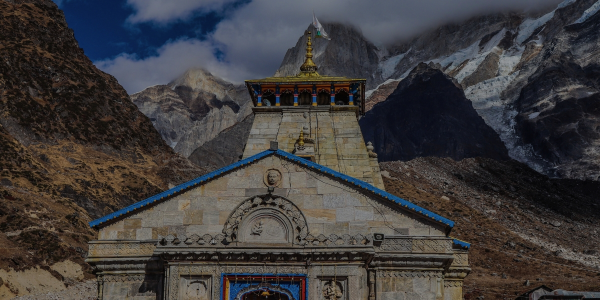
Kedarnath Dham Route Map
Kedarnath is the dham where almost every pilgrim feels deeply emotional. It may be because the route is tough, or because the feeling is very strong. People believe that Baba Kedarnath calls devotees in his own way, and the journey to this shrine is one of the most powerful parts of the Uttarakhand pilgrimage experience.
To begin the journey, the road first takes you to Sonprayag. Vehicles stop here, and the place is always crowded with pilgrims and shared jeeps. From here, you wait for your turn to move towards Gaurikund. The jeep ride is short but full of activity. You hear the Mandakini River flowing beside the road, and you see small shops selling essentials like gloves, sticks, and rain covers. This stretch is an important part of the mountain travel plan followed by most yatris.
From Gaurikund, the real trek to Kedarnath begins. This is the most important section of the pilgrimage route. Some people walk slowly, some move faster, and many take short tea breaks along the way. Even strangers start talking and helping each other, as the mountains naturally bring people closer.
For those who cannot walk, ponies and doli services are available throughout the route. Many elderly pilgrims use them for comfort. Helicopter services are also available through Char Dham Helicopter Booking Package from places like Phata during the season, giving an easier option for the journey. These choices make the trek more flexible for different types of travellers.
The Mandakini River stays with you almost the entire trek. Sometimes you can see it clearly, and sometimes you only hear its sound. As you climb higher, the air becomes thinner, but the desire to reach the temple becomes stronger. Every step feels meaningful, and faith keeps you moving forward.
When the Kedarnath Temple finally appears in view, everything changes. Pain disappears, and emotions take over. Some people cry, some smile, and many just stand still in silence. It feels like Baba has been waiting for you all along.
A simple travel plan of the Himalayan temple circuit helps a lot here. You understand the turns, rest points, and distances in advance, which reduces fear and confusion. Step by step, with prayer in your heart, you move closer to divine blessings.
From | To | Distance |
|---|---|---|
Delhi | Haridwar | 210 km |
Haridwar | Rishikesh | 25 km |
Rishikesh | Devprayag | 75 km |
Devprayag | Srinagar | 35 km |
Srinagar | Rudraprayag | 33 km |
Rudraprayag | Guptkashi | 45 km |
Guptkashi | Sonprayag | 30 km |
Sonprayag | Gaurikund | 5 km (shared jeep) |
Gaurikund | Kedarnath | 16 km trek |
Kedarnath new trekking route
From | To | Distance |
|---|---|---|
Gaurikund | Jungle Chatti | 4 km |
Jungle Chatti | Bheembali | 3 km |
Bheembali | Lincholi | 4 km |
Lincholi | Kedarnath | 4 km |
Badrinath Dham Route Map
Badrinath is the last dham in the Chardham Yatra. Many pilgrims say, “When we reach Badrinath, it feels like we have achieved something truly meaningful in life.” This place holds deep spiritual value. It is the final stop of the sacred Himalayan pilgrimage journey, and the feeling of arrival is always special when you book a Divine Char Dham Yatra Package.
The drive to Badrinath usually begins after Kedarnath darshan. Most travellers take rest stops in places like Guptkashi or Rudraprayag before continuing ahead. This break helps the body recover from long travel. The next day feels more relaxed and fresh for the mountain drive.
The road is not flat. It moves through hilly terrain, so the journey is slow at times. But it never feels dull. The Alaknanda River flows alongside the route for a long stretch, adding beauty and calmness to the journey. You can hear the river sound from your window while driving. Small bridges appear on the way, and the road keeps moving up and down through the mountains. The weather also keeps changing sometimes cool breeze, sometimes warm sunlight, and then cold again.
There are many important stops on the way. Karnaprayag and Nandprayag are well-known confluence towns where rivers meet. Many travellers stop here for tea and short breaks. These pauses make the journey more comfortable. You also pass through small villages where children often wave at passing vehicles. Life here looks simple, peaceful, and closely connected to nature.
Joshimath is the main halt before Badrinath. It is a busy town with hotels, shops, and travel facilities. If the road ahead has snow or weather issues, travellers may wait here. When the route opens, there is a clear sense of excitement because the final destination is near. From Joshimath to Badrinath, the scenery becomes even more stunning. Snow-covered peaks look closer, and light mist often covers the hills, making the journey feel divine.
Finally, you reach Badrinath town, where the temple stands at the center. There is no long trek only a short walk for darshan. This makes it easy for families and elderly pilgrims to visit together and complete their spiritual journey peacefully.
Having a clear Himalayan pilgrimage travel plan helps a lot. You understand the route, read signboards easily, and travel without confusion. This brings confidence, comfort, and a deeper sense of devotion throughout the journey.
From | To | Distance |
|---|---|---|
Delhi | Haridwar | 206 kms |
Haridwar | Rishikesh | 24 kms |
Rishikesh | Devprayag | 74 kms |
Devprayag | Srinagar | 34 kms |
Srinagar | Rudraprayag | 33 kms |
Rudraprayag | Karnaprayag | 31 kms |
Karnaprayag | Nandprayag | 21 kms |
Nandprayag | Chamoli | 10 kms |
Chamoli | Joshimath | 48 kms |
Joshimath | Badrinath | 42 kms |
Route Map for Char Dham Yatra
The Chardham Yatra begins from the plains and gradually takes you into the high Himalayan mountains. Most pilgrims start their journey from Haridwar or Rishikesh, as both places are well connected by train, bus, and flight via Dehradun Airport. From here, the real mountain travel route begins.
Standard Yatra Route
Haridwar / Rishikesh → Yamunotri → Gangotri → Kedarnath → Badrinath
This traditional sequence is followed every year. It helps maintain a smooth flow of travel and keeps the journey spiritually balanced. First come the holy rivers, then the divine presence of Lord Shiva at Kedarnath, and finally the blessings of Lord Vishnu at Badrinath.
As you travel along the Himalayan roads, clear signboards guide you at every turn. Experienced drivers who regularly operate on this route ensure safe travel through mountain terrain. Along the way, you will pass through small towns, roadside dhabas, and local shops where travellers can rest and refresh themselves.
In some areas, mobile network may not work properly due to high altitude. That is why carrying a printed or saved travel plan is very helpful. Many pilgrims also choose to stay extra nights at certain stops to rest and enjoy the mountain scenery at a relaxed pace. There is no need to rush the journey is meant to be peaceful and comfortable according to each person’s health and preference.
A clear journey plan with distances between destinations helps in better preparation. It allows you to estimate travel time, plan night halts, and keep your family informed. When stops are marked in advance, the entire group feels more confident and relaxed.
This simple route guide acts like a reliable travel companion. It keeps you on the right path throughout the Himalayan pilgrimage and helps you focus on devotion rather than confusion. With proper planning, your journey becomes smoother, safer, and more meaningful until the final darshan at Badrinath.
From | To | Distance |
|---|---|---|
Delhi | Rishikesh | 230 km |
Rishikesh | Yamunotri | 210 km + trek |
Yamunotri | Gangotri | 240 km |
Gangotri | Kedarnath | 260 km + trek |
Kedarnath | Badrinath | 200 km |
Badrinath | Delhi | 520–550 km |
Important Cities and Towns That Come During Chardham Yatra
During the Chardham Yatra, the road passes through many small towns that provide food, stay, and basic travel support. These places are not just halts they are an important part of the entire pilgrimage journey. Each town has its own role, comfort, and charm as shown in the char dham yatra route map.
Haridwar and Rishikesh: These are the starting points for most pilgrims. Both cities are well connected and offer everything needed for the journey warm clothes, medicines, rain gear, and travel essentials. The Ganga Aarti here gives a peaceful and spiritual beginning to the yatra. These cities clearly mark the starting point of the char dham yatra map.
Barkot: A calm and scenic town on the way to Yamunotri. After a long drive, pilgrims usually rest here. The surroundings are filled with green hills, and many hotels and homestays are available for a comfortable stay.
Janki Chatti: This is the last motorable point for Yamunotri. From here, the trek begins. Pony services, palki options, tea stalls, and small shops selling walking sticks and rain gear are easily available. The onward journey on foot starts here as shown in the char dham route map by road.
Uttarkashi: A major mountain town and an important stop before Gangotri. It has many temples, ashrams, and good stay options. Pilgrims also refill supplies, buy woollens, and take proper rest here before moving ahead.
Harsil: A quiet and beautiful valley close to Gangotri. It is known for its natural beauty, apple orchards, pine forests, and fresh cold air. Many travellers prefer staying here for a peaceful experience.
Guptkashi and Sonprayag: These are key stops before Kedarnath. Sonprayag is the last point where private vehicles stop, and from here jeeps take pilgrims to Gaurikund. Guptkashi offers many hotels and accommodation options for night stay.
Gaurikund: This is the starting point of the Kedarnath trek. It has hot water springs, small shops, and basic facilities for pilgrims. The trek route officially begins from here as marked in the Chardham yatra map.
Rudraprayag: A major town located at the meeting point of rivers. It is commonly used as a night halt while travelling between Kedarnath and Badrinath. It offers good stay and food options.
Joshimath: The last important stop before Badrinath. Many pilgrims stay here if weather conditions change. It is also the gateway to Auli and offers all basic travel facilities.
Along the entire char dham yatra route map, these towns act as support points for food, rest, medical help, and accommodation. Travellers from all over India meet here and share the same spiritual journey. These places are important stops in the Char Dham Accommodation Guide, ensuring every pilgrim reaches each dham safely, comfortably, and with faith.
Key Points for Char Dham Yatra
If you are planning the Char Dham Yatra, there are a few important things you should know before starting. These points will help you travel safely, comfortably, and without confusion.
Registration: All pilgrims must complete Char Dham Yatra Registration Guide before the journey. This helps in managing safety and crowd control. You can register online through the official Uttarakhand Tourism website. Keep a copy of your registration for checking at different points.
Helicopter Services for Kedarnath: For Kedarnath, helicopter services are available for those who want an easier journey. Tickets can be booked online through official platforms like IRCTC or Uttarakhand Tourism. Always carry printed tickets and a valid ID for verification at the helipad.
Best Time to Visit: The Best time for the Yatra is explained in Best Time to Visit Char Dham Yatra and September to October. During these months, the weather is usually pleasant and safe for travel in the mountains.
Health and Fitness: The Kedarnath trek requires good physical strength. It is recommended to do light exercise like walking or cardio before the trip. Also, take a basic health check-up, especially if you have any medical issues.
Packing Essentials: Pack smart and light. Some important items include - Warm clothes (layers), Good trekking shoes, Waterproof jacket or raincoat, First-aid kit and basic medicines, Water bottle and light snacks, Energy or hydration drinks
Travel Packages
Many travel companies offer different types of Char Dham packages based on needs:
Complete 4 Dham Package: Covers all four temples with stay, food, and transport
Helicopter Package: Quick and comfortable journey option
Family Package: Designed for families, especially with elders
Budget Package: Affordable travel with basic facilities
Custom Package: Flexible plan based on your dates and choice
Kedarnath Yatra Registration & Helicopter Booking
Registration can be done on the official Uttarakhand tourism portal. You need to enter your details and upload ID proof.
Helicopter tickets are available through IRCTC and official booking portals.
Common helipads include Phata, Sersi, and Guptkashi.
Prices are fixed by the government, so always book from official sources only.
Do’s and Don’ts for a Safe Journey on the Char Dham Yatra Route
Do’s (Must Follow) | Don’ts (Avoid These) |
|---|---|
Plan your trip and follow the proper route map | Do not rush or skip rest, as it may affect your health |
Start early each day to avoid traffic and weather issues | Avoid travelling at night in hilly areas |
Carry a valid ID and complete your yatra registration | Do not ignore weather warnings |
Pack warm clothes, rainwear, and good trekking shoes | Avoid carrying heavy luggage during treks |
Drink enough water and eat light food | Do not drink alcohol or smoke at high altitudes |
Take rest and adjust to the altitude, especially before Kedarnath | Do not litter; keep the environment clean |
Book hotels and transport in advance during peak season | Do not depend fully on mobile networks |
Follow local rules and government guidelines | Avoid unregistered travel services |
Hire local guides for treks if needed | Do not skip medical check-ups if you have health issues |
Keep emergency contacts and basic medicines with you | Do not take unknown or unsafe routes |
Why Understanding the Char Dham Yatra Route Map Is Important
Understanding the Char Dham Yatra route map helps pilgrims:
Plan realistic daily travel distances
Manage altitude-related health risks
Schedule darshan and rest breaks efficiently
Avoid weather-related route disruptions
Reduce physical exhaustion during the journey
Best Char Dham Route Based on Your Travel City
Pilgrims travelling from Delhi usually start their journey via Haridwar before entering the Char Dham circuit. Those coming from Mumbai or Bangalore often fly into Dehradun and continue the yatra by road. Similarly, travellers from Ahmedabad or Pune generally reach Haridwar or Dehradun before starting the Char Dham Yatra route.
FAQ's
Author Information

Written By: Abhishek Rai author
Abhishek Rai is a seasoned content writer and digital marketing specialist with a decade of experience in crafting high-impact narratives for the digital age. With a career spanning over 10 years, Abhishek has mastered the art of blending strategic storytelling with data-driven marketing to help brands find their unique voice. His expertise goes beyond simple wordplay; as a digital marketing specialist, he understands the mechanics of SEO, audience psychology, and conversion optimization. Whether it’s technical whitepapers, engaging blog content, or comprehensive digital strategies, Abhishek's work is defined by its clarity, purpose, and ability to drive results.
Last Updated: July 14, 2026
Related Pages

Jan 21, 2026 | 1 Min Read

Dec 23, 2025 | 1 Min Read

Dec 15, 2025 | 1 Min Read
Dec 15, 2025 | 1 Min Read

Dec 15, 2025 | 1 Min Read

Dec 15, 2025 | 1 Min Read

Dec 15, 2025 | 1 Min Read
Dec 15, 2025 | 1 Min Read

Dec 15, 2025 | 1 Min Read
.webp)
Dec 14, 2025 | 1 Min Read
Last Updated: July 14, 2026
